Beyond Pretty Pictures: Practical Applications of Drone Mapping in Southern Alberta
Drone Mapping in Southern Alberta: More Than Just Pretty Pictures!
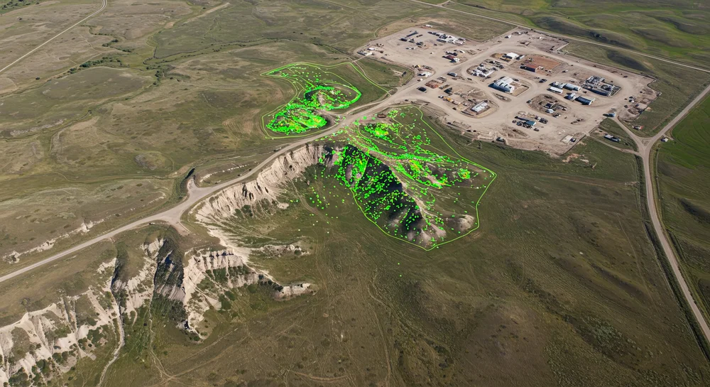
Sure, drones take amazing photos and videos, but did you know they’re also super-smart map-makers? We’re talking about getting really precise data from the sky that helps businesses make better decisions right here in Southern Alberta. With our big farms, varied landscapes, and all the building going on, drone mapping is a total game-changer. Using cool tech like photogrammetry (fancy word for making maps from photos) and LiDAR (lasers!), drones can whip up detailed maps, 3D models, and elevation charts that seriously boost efficiency.
At Coalbanks Creative, we’re experts at turning that high-flying data into useful info for folks in Lethbridge and around. Whether you’re building stuff, growing crops, or managing land, we tailor our drone mapping to fit what you need here in Southern Alberta.
How Folks Are Using Drone Maps Around Here
Drone mapping isn’t just theoretical; it’s helping real businesses in Southern Alberta save time, money, and headaches:
-
Builders & Developers:
- What Drones Do: Keep a constant eye on how construction sites are progressing, figure out exactly how much dirt needs to be moved (cut/fill – saves guesswork!), check that things are built according to plan, and even help plan site safety better with a bird’s-eye view.
- Real Lethbridge Example: One local construction company used drone maps for a highway project and cut their survey time by a whopping 40%, saving around $15k in labor! Not bad, eh?
- Why It’s Smart: Less time spent walking the site with measuring tapes, fewer mistakes, better tracking, and helps keep those important projects on schedule. Super handy with all the building happening in Alberta.
-
Farmers & Ag Producers:
- What Drones Do: Check on crop health (using special cameras that see more than our eyes!), figure out the best way to water fields, plan drainage using super-accurate elevation maps, and basically farm smarter, not harder (that’s precision ag!).
- Real Southern Alberta Example: A farmer near Taber used drone data to tweak their irrigation and saw yields go up 15%, saving about $10k a year. Sweet!
- Why It’s Smart: Special drone sensors can spot problems like thirsty plants or pesky bugs early on. Fixing problems quickly means bigger yields and more profit in our tough farming market.
-
Land Managers (Cities, Counties, Environmental Groups):
- What Drones Do: Keep track of changes in the environment (like erosion or how plants are doing), help manage resources wisely, plan routes for things like pipelines or utilities, and get accurate info for property lines.
- Real Lethbridge Example: The City has used drone mapping to check out flood risks along the Oldman River – much easier and cheaper than sending crews out on foot! Helps with smarter city planning.
- Why It’s Smart: Getting good, current maps helps with planning sustainable projects, following environmental rules, and just generally taking good care of our beautiful Southern Alberta landscapes.
Why Drone Mapping is a Great Fit for Our Neck of the Woods
Southern Alberta’s got it all – the coulees near Lethbridge, wind turbines near Pincher Creek, wide-open prairies towards Medicine Hat. Getting good data across these diverse areas needs tools that are fast and accurate. Drone mapping totally fits the bill:
- Saves You Money: Drone surveys can often cost up to 50% less than the old-school ways. That means more money left in your budget for other important stuff.
- Super Speedy: Need to map a big 100-acre area? A drone can often do it in hours, not days. Faster data means faster decisions and projects stay on track.
- Crazy Accurate: We’re talking centimeter-level accuracy here! Whether using photos (photogrammetry) or lasers (LiDAR), the data is reliable enough for serious planning and engineering.
- Keeps People Safe: No need to send crews scrambling over rough terrain or near dangerous equipment like power lines or bridges. Drones handle the risky parts.
Studies even back this up – construction projects can see costs drop by 30%, and farms can boost yields by up to 20% using drone data. That’s real money for Southern Alberta businesses!
Beyond Basic Maps: Cool Sensor Tech We Use
Our drones aren’t just carrying regular cameras (though they do that too!). We can pack them with advanced gear to get even more useful info:
- Heat Vision (Thermal): Spot hidden problems by looking for temperature differences. Think leaky irrigation pipes, buildings losing heat, faulty solar panels, or overheating electrical bits.
- Super-Detailed 3D Models: Create incredibly accurate digital copies of sites or structures. Perfect for designers and engineers using CAD or GIS software to plan, measure, or visualize things.
- Plant Health Check-ups (Multispectral/NDVI): Special cameras see light our eyes can’t, helping us figure out how healthy crops are, where they might be stressed, or how well they’re growing. Super useful for farmers wanting to be precise!
Getting this kind of detailed data helps businesses plan smarter, fix problems faster, and manage resources better.
Got Questions? We’ve Got Answers!
Thinking about drone mapping? You might be wondering…
- “Is this all legal and above board?” Yep! Coalbanks Creative plays strictly by the Transport Canada rulebook. Our pilots are certified (Advanced Ops!), and we handle all the permits and permissions needed, especially if we’re flying near the airport (YQL) or in tricky spots. No worries there!
- “Can these things handle Alberta wind?” Good question! Our pro-level drones are built tough with good stabilization to handle typical Southern Alberta breezes. We always check the forecast and plan flights for safe conditions to make sure we get great, reliable data.
- “What happens to my data? Is it secure?” Absolutely. We treat your project data like top secret info. It’s stored securely, handled confidentially, and only shared with the people you say it’s okay to share it with.
Why Choose Coalbanks Creative? We’re Local Experts!
Working with us, your friendly neighborhood Lethbridge drone team, has its perks:
- Certified Pros Who Know Mapping: Our pilots have the official certs and real-world experience needed for even complex mapping jobs. We’re ready for advanced stuff too!
- We Know Southern Alberta: From downtown Lethbridge streets to the fields around Cardston, we understand the local landscape and how to plan flights effectively here.
- Data You Can Actually Use: We don’t just give you a pile of numbers or confusing maps. We provide clear reports and data (like volume calculations for builders or crop health maps for farmers) that make sense and help you make smart decisions.
See the Real-World Wins!
Think about it: a Lethbridge developer cutting weeks off their survey time for a new neighbourhood, or a farmer near Coaldale spotting a pest problem super early before it causes big damage. That’s the kind of practical, money-saving stuff drone mapping helps achieve. Check out our past work to see more examples!
Ready to Put Drone Mapping to Work for You?
Drone mapping is precise, fast, and saves money – it’s becoming a must-have tool for smart businesses in construction, farming, land management, and more around Southern Alberta. Coalbanks Creative is here to help your project succeed with top-notch aerial data. Give us a shout for a free chat!